Wednesday, November 20, 2013

Ships Log- Day Seven- November 20, 2013

                                         Ships Log- Day Seven- November 20, 2013

Mile 264.1- Heading south to Wrightsville Beach,  NC. It's really fun- when you are passing someone you get on the marine radio and say "Sportfisher"( type of boat), the name of their boat, say Cloud Nine) "Cloud Nine, approaching on your port side, permission to overtake on your port (left) side. Then Cloud nine says "Yes Captain", and Steve says "thank you Captain, I'll keep it slow." It's very polite.

North Carolina has to be one of the most beautiful states. There are marshes with long grasses that weave around the inlets, gorgeous homes with their own little docks. So picturesque.


This has got to be Jimmy Buffets house!!
 We made it to Wrightsville Beach and a great marina. The showers are even tiled!


The dock girl lets you use her car and we were able to go to Westmarine (they are everywhere along the east coast) and we went to the grocery store to stock up. Steve and I did our laundry together and went to a fabulous meal at the marina restaurant- we love to eat at the restaurants at marinas so we could look out at the boats a "someday we'll own our own boat and that will be us!!!! and now it is!!! Very grateful.
fun boat!! (Worth about $3 million)

Tuesday, November 19, 2013

Ships log Day 6, November 19, 2013


November 19, 2013

Mile 202- 6:55 am- Taking off from Beaufort, NC.

Today  I held the rope while Steve got out the Marina slip- he did a fabulous job even tho the current was pushing him back to the docks. Very smooth. We are following the “Live Wire” who has done this route many times. This stretch is very tricky as it has “shoals” (high areas of shifting sand and sand bars) everywhere. That is way it is so important to stay right on the ICW path that has been laid out- it is really easy to run aground if you get even a few feet off.

At 9:50 we all stopped –thought someone had run aground- everyone turned with their sides facing across the ICW and put the boats in neutral or very slow so you can still control your position and not run into any of the marshes and shoals.

It turned out there was a live firing range at the Marine Base at Camp Lejeune and traffic had to be stopped so they could keep practicing.  We have to wait here for an hour. Then we have a bridge to go under that opens on the hour and the half hour. We’ll see if we make it!!

It was good to have this break because while we wait for the gunfire to stop and Steve keeps the boat from going aground on the shoals, I get to use the hand pump to get the water out of the toilet that keeps filling up and soaking the carpet…..oh the glamour of the yachting life!!!!!

10:49- we are finally going on!! The Marines have stopped shooting so they gave us the go ahead- now we are hoping to get through the bridge before it closes!!! (Opens and closes on the hour and half hour.)

 Had to leave the group because Steve wanted to check something on the transmission. He even had to put on a wetsuit and jump overboard to look and see if anything caught on the propellers! The water here was freezing!!!! It took his breath away!!!!!!!!!!!!! Nothing caught so he went down to the hole and investigated and analyzed it looked like he just needed to change out the fluid- which he would at the next stop tomorrow at Wrightsville Beach. All those years operating heavy equipment paid off!


Even when you have an unexpected stop, life on a boat is beautiful!!


Monday, November 18, 2013

Ships Log Day Five- November 18, 2013

Ships log Day 5, November 18, 2013

Mile 187.0 Leaving the Oriental Marina.

Steve backed the boat out of the slip like a pro. It’s all coming back to him! Even got a “Good job” out of Capt Eric! Today Eric taught me how use to the Garmin Plotter to navigate; it will take a while before I really have it down, but I can do the basics. On the Intracoastal Waterway the plotter shows the route that you have to keep your boat in (white) and there is a little boat on the screen (us) and a magenta line in the middle. You have to keep it on that path. There are little red and green markers on the map and little warning dots that say “submerged piling” and such. It isn’t 100% accurate, so the most important tool is your vision- there was a time when the white line would have put us onshore! The ICW is a lane that is marked by red signs on posts (“Red Right Return”) that are on the right or starboard side and green on the left or Port side. That is unless you are at an inlet going to the ocean or an opening going into a river- in that case it is the opposite. You have to keep between the red and the green signs.


This is the “test” day for Steve with Eric only observing. Steve has been driving the boat with Eric stepping in and navigating, teaching Steve a refresher course on the rules of boating, navigation and electronics. He has been invaluable. Steve has driven boats before- from the time he was 11 he had a boat that he took fishing all by himself- out to Newport Harbor and then he would follow the chum line of the party boats as they went fishing along the coast to Dana Point- of course he wouldn’t tell his mom he went out on the ocean!!!

In the late 70’s and early 80’s we were members of the Lido Boat Club, took boating safety classes and used the boats there- sailing and power. The largest was 42’. This one is 53’ and a lot beefier. 
Beaufort Docks

Mile 202. We made it to Beaufort, NC (pronounced Bofort as opposed to the one in South Carolina, pronounce Bewfurt- can’t get them mixed up or the locals WILL correct you!
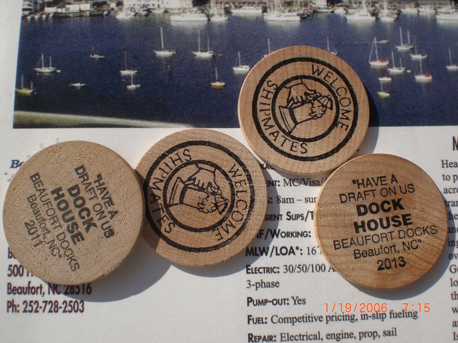
Beaufort NC is a darling town- apparently one of the biggest boating/sailing towns in the country. When we checked in the Beaufort Docks they help you dock, fill up the fuel (only 38 gallons!!) and buy you a beer!

I was really nervous for Steve- there was a strong current pushing him to the docks and they wanted him to BACK IN between two pilings that looked too small to fit between!!!! He had to figure out how to move the boat SIDEWAYS- and he did it perfectly...... what a guy!!!!!!!! Capt Eric was blown away!!!!!!!!!!!
Narrow dock- is calm now!!! Choppy before!

Send off to our wonderful Captain Eric- we can never thank you enough!!
  We will be following another couple to Wrightsville, NC tomorrow.   In a few days if the weather is good we will then run outside to bypass ICW in Georgia as we heard it was a mess...you travel 5 miles to make 1 mile of progress.  From Charleston, SC we will be able to make Amelia Island, Florida (120 miles).    Today we gave Eric a send off befitting a good captain as he headed to Idaho to see his father, who had a stroke- here's praying for a quick and complete recovery. 

So now the adventure begins...if we get lost we'll do like Captain Ron did "just pull over a ask for directions."  


Sunday, November 17, 2013

Ships log- Day 4 at sea- November 17, 2013

Ships log Day 5, November 18, 2013

Mile 187.0 Leaving the Oriental Marina.

Steve backed the boat out of the slip like a pro. It’s all coming back to him! Even got a “Good job” out of Capt Eric! Today Eric taught me how use to the Garmin Plotter to navigate; it will take a while before I really have it down, but I can do the basics. On the Intracoastal Waterway the plotter shows the route that you have to keep your boat in (white) and there is a little boat on the screen (us) and a magenta line in the middle. You have to keep it on that path. There are little red and green markers on the map and little warning dots that say “submerged piling” and such. It isn’t 100% accurate, so the most important tool is your vision- there was a time when the white line would have put us onshore! The ICW is a lane that is marked by red signs on posts (“Red Right Return”) that are on the right or starboard side and green on the left or Port side. That is unless you are at an inlet going to the ocean or an opening going into a river- in that case it is the opposite. You have to keep between the red and the green signs.


This is the “test” day for Steve with Eric only observing. Steve has been driving the boat with Eric stepping in and navigating, teaching Steve a refresher course on the rules of boating, navigation and electronics. He has been invaluable. Steve has driven boats before- from the time he was 11 he had a boat that he took fishing all by himself- out to Newport Harbor and then he would follow the chum line of the party boats as they went fishing along the coast to Dana Point- of course he wouldn’t tell his mom he went out on the ocean!!!

In the late 70’s and early 80’s we were members of the Lido Boat Club, took boating safety classes and used the boats there- sailing and power. The largest was 42’. This one is 53’ and a lot beefier. 
Beaufort Docks

Mile 202. We made it to Beaufort, NC (pronounced Bofort as opposed to the one in South Carolina, pronounce Bewfurt- can’t get them mixed up or the locals WILL correct you!
Beaufort NC is a darling town- apparently one of the biggest boating/sailing towns in the country. When we checked in the Beaufort Docks they help you dock, fill up the fuel (only 38 gallons!!) and buy you a beer!

I was really nervous for Steve- there was a strong current pushing him to the docks and they wanted him to BACK IN between two pilings that looked too small to fit between!!!! He had to figure out how to move the boat SIDEWAYS- and he did it perfectly...... what a guy!!!!!!!! Capt Eric was blown away!!!!!!!!!!!
Narrow dock- is calm now!!! Choppy before!

Send off to our wonderful Captain Eric- we can never thank you enough!!
  We will be following another couple to Wrightsville, NC tomorrow.   In a few days if the weather is good we will then run outside to bypass ICW in Georgia as we heard it was a mess...you travel 5 miles to make 1 mile of progress.  From Charleston, SC we will be able to make Amelia Island, Florida (120 miles).    Today we gave Eric a send off befitting a good captain as he headed to Idaho to see his father, who had a stroke- here's praying for a quick and complete recovery. 

So now the adventure begins...if we get lost we'll do like Captain Ron did "just pull over a ask for directions."  


Saturday, November 16, 2013

Ships Log- Day Three-November 16, 2013

                                 Ships log day Three at Sea November 16, 2013

Pushed off at 9 am.  Mile 12. We aren’t going to encounter as many bridges today. As a matter of fact we will be getting into a wider area and be able to actually pick up speed. It was a great time yesterday for Steve to practice turning and maneuvering the boat while waiting for the bridges to open while Eric was giving him insight and pointers. 

Altho the books say the ICW is gorgeous, Steve says it kind of reminds him of the movie Deliverance! There are plenty of birds tho. Th color of the water is a really weird color caused by the large amount of tannic acid that seeps from the juniper and cypress trees along the bank.It looks dirty dark beer.

Mile 33.9- North Carolina Border!

Mile 42-We are making good time and coming in to Currituck sound. Getting prettier here! We were going to stop at Coinjock and eat at Crabby’s Bar (isn’t it sweet they named that after me!!!!) but are rolling along so we can make it to

Alligator River Marina- don’t think I want to jump in the river here!

5pm- Mile 84.4-Made it in to the little Marina and fuel station at Alligator River. Fueled up and only took 106 gallons! It was something like 350 from Annapolis to Great Bridge! Shannie said she and Roy need to invest in Marine Fuel as the consumption level was going up!!!!

Steve and Eric celebrating their great day with cocktails on the aft deck. Job well done!! We had burgers and Capt Eric had fried okra and shrimp! Restaurant was great, shower was nasty- Steve had to use a half a bottle of sanitizer on his feet- gross!!!

Friday, November 15, 2013

Ships Log- Day Two- November 15, 2013

Ships log day two November 15, 2013

10:52 am- leaving Norfolk (mile “0”) heading south! Going down “The Ditch” That is the nickname for Intracoastal Waterway.
Mile “0” is in Norfolk Virginia. This is one of the largest shipyards in the world. All Navy, all the time. There is no doubt who you root for at the Army Navy game! We travel along until under a massive bridge as you encounter a seven mile long congested stretch with six bridges.


They say that you should enjoy the ride and the scenery on the Intracoastal Waterway. That is because you have no choice. It is all stop and go, stop and go, and stop. The fastest you can motor is 6 mph, but you don’t get a chance many times to go that “fast” for long. There are bridges that you have to wait to open-the hours that are posted don’t always coincide with what the operators do on that particular day..
What I have found fascinating is the different types of bridges- at mile 2.6 and 3.6 are railroad bridges, pictured below.  The Jordon Lift bridge at mile 2.8 was dismantled in 2009 and the center span removed so you can go right through this one. The Gilmerton Bridge at mile 5.8 was having electrical problems…a 30 minute delay. The way it works is so cool. I took a few different pictures so you can see it.
                                    

This is with the bridge down to let the trains cross. The next is 1/3 the way up- the huge cable on either side pull the middle portion of the bridge up. You have to call on your radio to have it raised. A sailboat had called in and we asked the bridge if we we could follow it in. They said to go ahead. If you don’t time the bridges right, you could be idling in the river for 3+ hours…


Or if you miss the “Great Bridge Lock” you have to wait until noon the following day!


Two more bridges we went though.
At mile 7.2, you get to choose two routes south; the first one is Dismal Swamp. It is narrow and only 6 feet deep in spots. Do you think anyone would pick this???? The one we went on was the Virginia Cut. The depth is 12 feet with a channel width of 90 feet. It still seems pretty narrow with the traffic going both ways with giant tugs and barges.

The Great Bridge Lock was really fun. Mile 11.5. It is like a mini Panama Canal. We almost missed it because of the delays with the other bridges. It was only opened from 11 am until 2 pm. Luckily Captain Eric heard that a tug had a special pass and he allowed us to get in front of him. You enter in with a few other vessels and the back panel closes. Everyone ties up and the water starts rising!!
Steve tying up to the pilings
Susie holding the line
Nice tug boat guy carrying pipes- they cap each end so they float! The pipes were so long I couldn’t get them all in the picture! The tug and the pipes went all by themselves in the lock next! The picture on the right (or starboard in boat speak) is the lock with the water level down.

Cute guy on boat tying the boat off and putting out the fenders (the rubber bumper things for Capt Ron fans) is Steve and I'm holding a line while the lock fills.

One more bridge, below. Mile 12.0 is the Great Bridge Bascule Bridge. Right after that is the fuel dock and marina slip where we tied up for the night. 

Ate at the Courthouse restaurant (a tradition in Great Bridge.) Their menu looks like a summons. Too funny. Great food.

All day and 12 miles!!


Thursday, November 14, 2013

Ships log- Day One at Sea!!!!! November 14, 2013

                                   Ships log day one at sea November 14, 2013
10:45 am-We left the fuel dock at Annapolis Maryland at 10:45 this morning and set out on our journey down the Intercoastal Waterway. We are cruising at 15 knots- 17.3 mph. Our goal today is Norfolk Virginia. We will probably reach it around 9pm. The sun is getting ready to set on the horizon. Its 4:51 pm. Seems a little early.
About an hour after we got underway we were visited by some flashing lights…the US Coast Guard!!!! Steve thought he was getting a ticket for speeding!! They boarded the boat and checked for compliance for safety regulations, if the boat was in our name, number of life jackets, flares, etc, etc. It was a little nerve racking!! Any way they were nice and we passed 100%! We are now good to go! 


4 pm- The seas have been pretty calm until the last hour or so. I’m in the cabin nice and warm; Steve and Eric are up top. We were fortunate to have a canvas company whip up a “dodger” or plastic windscreen or they would REALLY be freezing! Hopefully this will be our only late night. The guys have their cold weather gear on but I am definitely the comfortable one!
My sister asked if I was getting queasy, but so far so good. I’m sitting here writing this with a delicious glass of Chardonnay! (I know, typical!) Update: it’s about 6 pm now and the seas are pretty rough- we’ll test the wine theory.
This is such a dream come true for Steve and me. It started when we were in high school and talked about how fun it would be to live on a boat….. over 44 years later we finally are doing it!
Capt Steve

        I stole the following information from Wikipedia regarding the Intracoastal Waterway for anyone that’s interested.
         “At the request of the Senate in 1807, Treasury Secretary Albert Gallatin presented an overall plan for future transportation developments of national importance and scope. Along with inland east–west improvements, Gallatin's north–south improvements included the following:[2]

“
The map of the United States will show that they possess a tide water inland navigation, secure from storms and enemies, and which, from Massachusetts to the southern extremity of Georgia, is principally, if not solely, interrupted by four necks of land. These are the Isthmus of Barnstable, that part of New Jersey which extends from the Raritan to the Delaware, the peninsula between the Delaware and the Chesapeake, and that low and marshy tract which divides the Chesapeake from Albemarle Sound. ...
Should this great work, the expense of which, as will hereafter be shown, is estimated at about three millions of dollars, be accomplished, a sea vessel entering the first canal in the harbor of Boston would, through the bay of Rhode Island, Long Island Sound, and the harbor of New York, reach Brunswick on the Raritan; thence pass through the second canal to Trenton on the Delaware, down that river to Christiana or Newcastle, and through the third canal to Elk River and the Chesapeake, whence, sailing down that bay and up Elizabeth River, it would, through the fourth canal, enter the Albemarle Sound, and by Pamlico, Core, and Bogue sounds, reach Beaufort and Swansborough in North Carolina. From the last-mentioned place, the inland navigation, through Stumpy and Toomer's sounds, is continued until a diminished draught of water, and by cutting two low and narrow necks, not exceeding three miles together, to Cape Fear River, and thence by an open but short and direct run along the coast is reached that chain of islands between which and the main the inland navigation is continued, to St. Marys along the coast of South Carolina and Georgia. It is unnecessary to add any comments on the utility of the work, in peace or war, for the transportation of merchandise or the conveyance of persons.
9:00 pm- Going by huge ships in the Navy Shipyards.
9:29 pm- anchoring at Norfolk Virginia!!! Fabulous day!!!! 147 miles!!!!!!